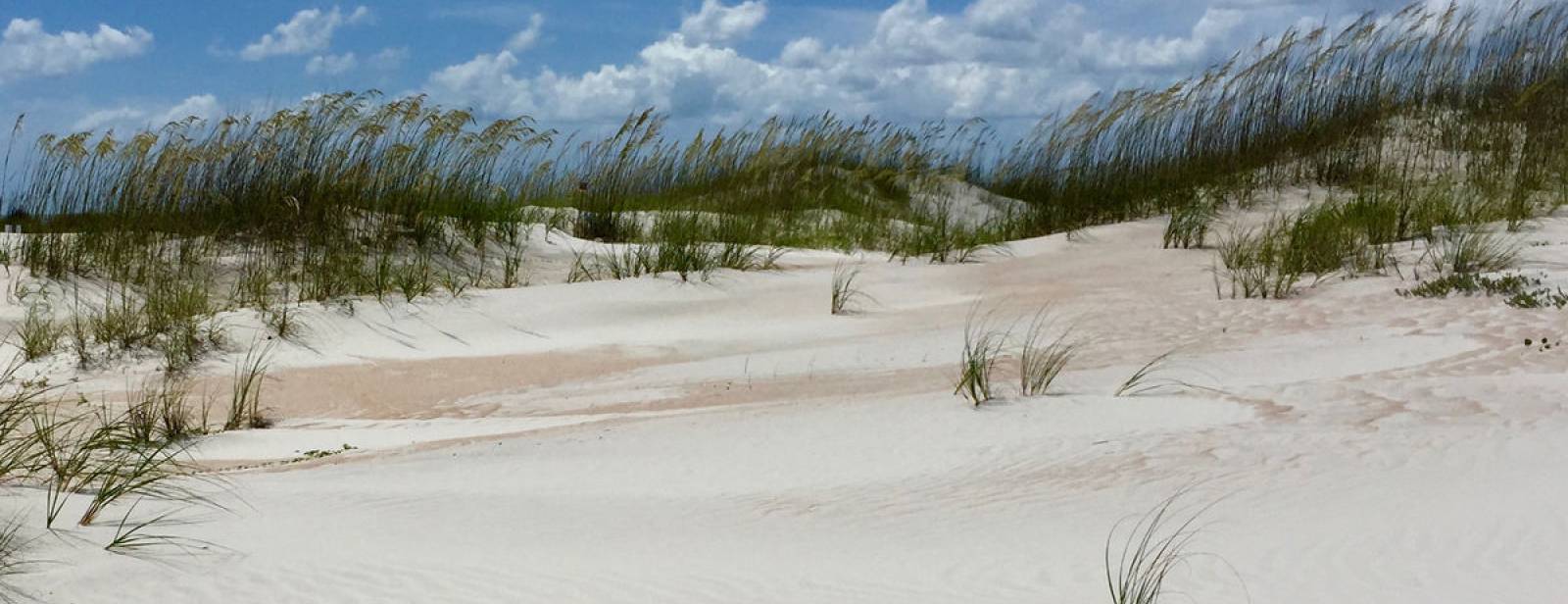
Florida Department of Environmental Protection Florida Department of Environmental Protection
More Protection, Less Process
* DEP Home * About DEP * Programs * Contact * Site Map * Search
MyFlorida.com  
Programs

Information

Some documents on this page are pdf files and require the free Adobe Acrobat Reader Software

Join our Mailing List!

Enter your e-mail address

spacer The Office of Park Planning

As one of the five bureaus or offices comprising the Division of Recreation and Parks, the Office of Park Planning provides a wide range of technical support and professional services beneficial to management of the Florida Park Service. Specific activities include:

Comprehensive Outdoor Recreation Planning

Florida is a magnet for outdoor recreation enthusiasts, blessed with natural places of great beauty that draw millions of residents and tourists each year. Florida’s state parks contribute to the worldwide allure of The Sunshine State. Not only do the parks provide access to varied and often unique natural, historic and cultural experiences but they also protect, preserve and maintain a dwindling supply of natural resources for enjoyment today and preservation for tomorrow.

Because of the State's phenomenal growth, providers of outdoor recreation facilities and services continue to be pressured to meet expanding demand. A fixed supply of land, water, shoreline areas, and cultural resources suitable for public use combined with fiscal constraints present public land managers with difficult decisions. State government must exercise a leadership role in coordinating the effective use of Florida’s recreation resources. But recognizing that the State alone cannot provide the volume or variety in types of leisure pursuits that will be needed by its present and future populations, the Legislature has given the Department of Environmental Protection specific responsibility to develop and execute a comprehensive, multipurpose outdoor recreation plan with the assistance of other public recreation land managers.

The purpose of the Statewide Comprehensive Outdoor Recreation Plan, (SCORP) is to guide the development of a diverse, balanced, statewide outdoor recreation system toward meeting current and future needs. It provides the framework for a statewide comprehensive outdoor recreation planning and implementation process.

A dynamic recreation resource supply inventory provides the foundation for Florida’s SCORP process. The Office of Park Planning maintains the database. The inventory is not only a planning tool for public and private recreation interests throughout the state but it also forms the basis of the statewide and regional supply and demand calculations found in Chapter 5 of the SCORP. View and interact with the Outdoor Recreation Planning (ORP) Inventory by following the link.

The National Park Service also requires each state to produce an updated SCORP every five years for continued eligibility to participate in and receive funding from the Federal Land and Water Conservation Fund (LWCF).

Outdoor Recreation in Florida - 2008

Table of Contents [PDF - 406 KB]
Chapter 1 - Introduction and Background [PDF - 1.06 MB]
Chapter 2 - Florida’s Outdoor Recreation Setting [PDF - 681 KB]
Chapter 3 - Outdoor Recreation Providers, Programs and Partnerships [PDF - 2.82 MB]
Chapter 4 - Outdoor Recreation Supply Profiles [PDF - 5.36 MB]
Chapter 5 - Outdoor Recreation Demand and Need [PDF - 343 KB]
Chapter 6 - Outdoor Recreation Trends and Issues [PDF - 1.23 MB]
Chapter 7 - Implementing Florida’s Outdoor Recreation Plan [PDF - 736 KB]
Appendices [PDF - 930 KB]

Document and Resource Links

Outdoor Recreation Planning (ORP) Inventory
Florida SCORP - Outdoor Recreation in Florida-2000

Land Acquisition and Administration

Land acquisition is critical in the effort to provide a well-rounded, diverse state park system capable of meeting its mission, “to provide resource-based recreation while preserving, interpreting, and restoring natural and cultural resources”.

The first steps in the provision of needed resources for public outdoor recreation in the state park system are identification, evaluation and establishment of priority projects for the Division’s land acquisition program. Using this priority acquisition list, staff coordinates with the Division of State Lands regarding negotiation efforts and scheduling to represent the interests of the Division and to ensure the timely matching of available money with negotiated projects.

Once properties are placed under the management jurisdiction of the Division, OPP then assumes land administration responsibility. This responsibility includes resolving land title or boundary disputes, encroachments, removal or relocation of use rights, and easements and other encumbrances, all to protect or improve recreational opportunities for the public either directly or in support of park operations.

Document and Resource Links

Division of Recreation and Parks Priority Acquisition List
Properties Under the Management Jurisdiction of the Division of Recreation and Parks
Florida Forever Land Acquisition Program

State Park Planning

The state park management plan forms the basis for all aspects of planning, budgeting, development, management and administration of the park. A major function of the management plan is to apply the philosophy and policies established in system planning to each park in the system on a localized basis. In doing this, the management plan considers the park in its broadest context, including external matters such as environmental threats, local economic impact and interaction with other existing parks.

Park management plans consist of two interrelated components. The resource management component complements the land use component by identifying the various measures and programs needed to achieve resource management objectives. The land use component allocates the park’s fixed supply of natural, cultural and recreational resources according to their optimum uses.

Resource Management Component

Park resource management planning is highly individualized, even between parks in the same locality. As in land use planning, the development of resource management plans involves applying system-wide policies to unique, resource-specific situations.

Resource management planning begins with a thorough and detailed inventory of the park’s natural and cultural resources, and an appraisal of their quality and condition. The purpose of this step is to identify resource management problems and needs. Next, specific management objectives and management measures for both natural and cultural resources are established, aimed at correcting identified deficiencies and sustaining the park’s resource base in perpetuity. At this stage, important decisions are made on such issues as ecological burning, exotic plant and animal removal, mitigation of environmental intrusions, protection measures for listed plants and animals and the long-term restoration of natural conditions.

Land Use Component

The land use component is the resource allocation plan for the park. Conceptually, park land use planning may be thought of as a continuum, dealing in its broadest sense with identifying various use “zones” for the park, and in the narrowest sense, with locating and designing individual facilities at specific use sites. The development of the land use component is a critical phase in park planning. It commits park land and water resources to preservation of existing conditions or restoration of natural systems and cultural resources, or to development for public or support uses along prescribed lines.

This process begins by examining the setting or environment in which the park exists, considering such matters as transportation access, population, and adjacent land uses. Existing on-site conditions, facilities and uses are then assessed. Exceptional, rare or sensitive areas and features are identified and set aside for special treatment. Another important output of this step is an analysis of the park’s recreation resource elements—those physical qualities that support the various resource-based recreation activities. In addition to providing a basis for determining the types and amounts of recreation the property will support, this analysis also identifies site limitations that may engender use conflicts, so efforts can be made to avoid them.

Once external factors and on-site attributes have been identified, an optimum allocation of the property’s physical space is made. This step involves locating use areas (both recreational and administrative), and deciding on the types of facilities and volume of use. The final step in the process, site planning, involves the designing of individual use areas and the locating of specific facilities. Final site plans are normally developed only as the need arises, based on the anticipated availability of funding.

The content, development and maintenance of unit management plans is directed by Florida Statutes 253 and 259.

State Park Unit Management Plans are available in Adobe.pdf format and can be viewed by clicking on the link below and then selecting the appropriate park name.

Document and Resource Links:

Approved State Park Unit Management Plans
DHR Cultural Statement
Florida Natural Areas Inventory Descriptions
Carrying Capacity Guidelines
Planning Process
Recreational Boating Access in Florida State Parks


State Park Mapping

Managing the natural resources of Florida’s state parks requires the assimilation and evaluation of many varied types of geographic and alphanumeric data. One of the functions of the Office of Park Planning is to produce, analyze and maintain geographic data on Florida state parks. This data is then incorporated into various goals, plans, programs and budgets.

Geographic Information System (GIS) technology facilitates access to the data, tools and support needed by staff to more effectively and efficiently perform tasks associated with land administration, resource management, land use planning, and operations.

Data currently in the system is used to produce the maps contained in the state park unit management plans. These maps show park boundaries and facilities (base map), soils, topography, natural communities, optimum boundaries and conceptual land use.

Document and Resource Links:

Florida State Park System Map
Large (36 X 36)
Small (8˝ X 11)

Florida State Park System District Maps
FPS District 1
FPS District 2
FPS District 3
FPS District 4
FPS District 5

(return to top)

Last updated: May 11, 2010


3900 Commonwealth Blvd · Tallahassee, Florida 32399  Information Line: (850) 245-2157
Contact Us
 

DEP Home | About DEP  | Contact Us | Search |  Site Map